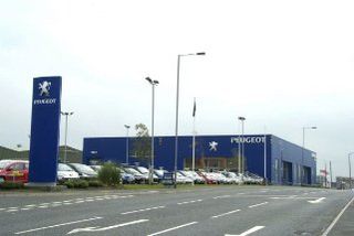
Peugeot locates dealership potential
The automotive company fine-tunes dealer catchment planning and streamlines reporting with new location-based analysis and mapping software.

Peugeot is using new geographical information systems (GIS) and mapping data to streamline the way plans its franchised UK dealer network and help target customers more precisely as well as analysing performance more effectively.
Peugeot's network development department looks after a network of some 300 franchised sales outlets around the UK and a further 40 repair-only operations.
The department has developed its own gravity modelling software to monitor the extent of its coverage, monitor dealer catchments and identify possible 'holes' in the network. But it wanted more flexibility in the way it presented and analysed this data in relation to the potential market.
"It's a constantly changing picture," said Andrew Bury, Peugeot's franchise network planning manager. "There are always opportunities to increase coverage in specific areas, or review markets in order to maximise sales opportunities."
GIS software and mapping data supplier MapMechanicswas brought in to replace an incumbent system with more graphical and automated functionality.
MapMechanics has supplied Peugeot with GeoConcept Expert, the PC-based GIS, plus NAVTEQ vector digital map data and road speed data from traffic information provider ITIS.
"The system makes it much easier for us to understand our market and make sure we're serving it as productively as we can," said Bury. "It's brought a vast improvement in usability over the systems we were using before."
Get the ITPro. daily newsletter
Receive our latest news, industry updates, featured resources and more. Sign up today to receive our FREE report on AI cyber crime & security - newly updated for 2024.
Peugeot has also streamlined the production of monthly sales reports for each dealer, modelling drive times to each franchised outlet to establish the attractiveness of each location. This information is then correlated with historical sales data and with the demographic profile of the area, drawn from Acorn demographic data.
The result is a detailed picture of the franchise network in relation to past sales and market potential, which GeoConcept can present thematically on screen and in print by means of graphs, charts and similar devices.
This helps the company to identify network over or under-provision, to resolve overlaps between catchments, to plan new franchise locations and to target advertising and promotion on a local and national basis.
The system also had to be intelligent enough to adopt different zoom levels for each map "on the fly." Using the system's Visual Basic development kit to build a bespoke utility to automate the whole process "gives us a high level of control over the task," said Bury.
The program uses GeoConcept's ability to read live sales data in directly from an Oracle database: "something we've never been able to do before," he said. The reports are produced with Business Objects software, which reads in the maps it generates.
A 25-year veteran enterprise technology expert, Miya Knights applies her deep understanding of technology gained through her journalism career to both her role as a consultant and as director at Retail Technology Magazine, which she helped shape over the past 17 years. Miya was educated at Oxford University, earning a master’s degree in English.
Her role as a journalist has seen her write for many of the leading technology publishers in the UK such as ITPro, TechWeekEurope, CIO UK, Computer Weekly, and also a number of national newspapers including The Times, Independent, and Financial Times.


