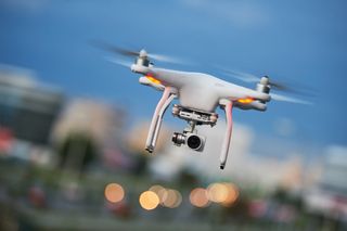
Police Scotland deploys drone fleet to find missing people
The emergency services outfit is the latest to adopt the unmanned aerial technology to help with rescue missions

Police Scotland has launched a new neural network-driven drone programme to help find people who have gone missing.
The technology onboard the fleet of drones, such as advanced cameras and AI-powered software, will allow pilots to determine whether something that appears on a screen is, in fact, a person.
When a camera is situated at great heights, it becomes difficult for the human eye to discern a 'speck' on the image from a silhouette of a missing person.
The advanced imagery technology - which is the result of a collaboration between Police Scotland, Thales and the University of the West of Scotland - can help identify missing people from up to 150 metres away. The software it uses to differentiate meaningless 'specks' from animals, vehicles or real people is light enough to be run on a smartphone and uses machine learning to continually increase its accuracy.
"The drone itself has very special sensors on it," said Insp Nicholas Whyte, of Police Scotland's air support unit to the BBC.
"There's a very highly-powered optical camera which can allow us to see things quite clearly from a good height. Also, there's a thermal imaging sensor which detects heat.
"We're there to find people. People who need our help or people who are lost."
Get the ITPro. daily newsletter
Receive our latest news, industry updates, featured resources and more. Sign up today to receive our FREE report on AI cyber crime & security - newly updated for 2024.
Growing adoption
The technology being deployed by Police Scotland is the latest in a line of deployments from emergency services across Britain in recent months.
The UK's Maritime and Coastguard Agency (MCA) announced in August that it was seeking applicants for its 990,000 drone contract to help search for missing persons up to 10km away from shore.
The technology would allow emergency responders to safely and remotely explore regions that would be difficult to investigate due to poor conditions such as low light, wind or fog.
The UK government also awarded funding to a variety of startups looking to use drone technology for more than cool cinematic shots and airport disruptions.
Among the successful applicants was Loughborough University which has developed technology to detect chemical hazards. Others were developing technology to detect gas leaks and assist decontamination missions.
Ordnance Survey also said earlier this year that it would start using solar-powered drone technology to collect better images of Earth than was previously possible.
The 145kg drone named Astigan will be able to fly for 90 days at 67,000 feet without stopping and will capture images which conventional aerial image technology would struggle to do.

Connor Jones has been at the forefront of global cyber security news coverage for the past few years, breaking developments on major stories such as LockBit’s ransomware attack on Royal Mail International, and many others. He has also made sporadic appearances on the ITPro Podcast discussing topics from home desk setups all the way to hacking systems using prosthetic limbs. He has a master’s degree in Magazine Journalism from the University of Sheffield, and has previously written for the likes of Red Bull Esports and UNILAD tech during his career that started in 2015.


